
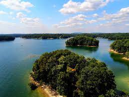
Drought conditions have creeped into parts of the Apalachicola-Chattahoochee-Flint (ACF) river basins resulting in a continued decline of lake levels, including Lanier’s, in the corridor, which runs from near Helen to the Gulf of Mexico.
The lates report from the U.S. Drought monitor shows widespread drought conditions in southwest Georgia and southeast Alabama through which include the ACF basin. A few areas in the northeastern and northwestern corners of Georgia are also now experiencing drought conditions. A map showing drought conditions in the southeastern U.S. can be found here: Southeast | U.S. Drought Monitor (unl.edu)
The Corps this week provided an update on current water releases from Buford, West Point, Walter F. George, George Andrews, and Jim Woodruff dams on the Chattahoochee River.
There’s more about what the Corps had to say here: Reservoir Releases Support Basin Wide Demands > Mobile District > Press Releases (army.mil)
(Pictured: Lake Lanier. Corps of Engineers’ photo)