


Last week, we were talking about a pending snowstorm. The week before that it was a coming ice storm. Now, the talk is about a big warmup, a “false Spring” some have labeled it even though there were a few snow flurries around Hall County early today. So, what’s going on?
“A ridge of high pressure will build eastward from the Great Plains this early next week,” the forecasters at the National Weather Service (NWS) office in Peachtree City tell us. “This will bring warmer weather to north and central Georgia.”
How warm?
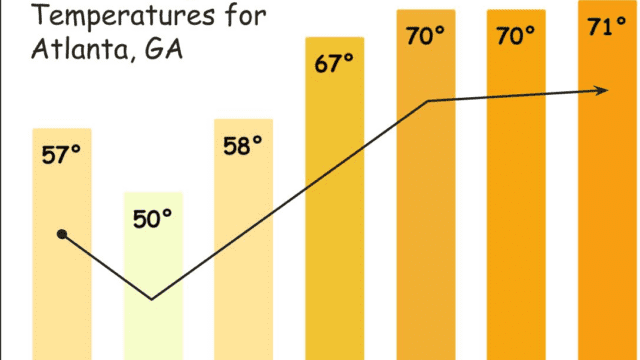
“For north and central Georgia, highs in the upper 60s and lower 70s next week.” And “No rain in the forecast through next Tuesday.”
The 7-day Gainesville area forecast:
Today
A chance of rain and snow showers before 11am, then a chance of sprinkles and flurries between 11am and noon. Patchy fog before 11am. Otherwise, mostly cloudy, then gradually becoming sunny, with a high near 47. West wind 5 to 10 mph, with gusts as high as 15 mph. Chance of precipitation is 30%. Little or no snow accumulation expected.
Tonight
Partly cloudy, with a low around 30. West wind 5 to 10 mph, with gusts as high as 15 mph.
Friday
Sunny, with a high near 53. West wind 5 to 15 mph, with gusts as high as 25 mph.
Friday Night
Partly cloudy, with a low around 34. Northwest wind around 15 mph, with gusts as high as 30 mph.
Saturday
Sunny, with a high near 50. Northwest wind 10 to 15 mph, with gusts as high as 25 mph.
Saturday Night
Mostly clear, with a low around 27.
Sunday
Sunny, with a high near 54.
Sunday Night
Partly cloudy, with a low around 36.
Monday
Sunny, with a high near 64.
Monday Night
Partly cloudy, with a low around 44.
Tuesday
Mostly sunny, with a high near 66.
Tuesday Night
A 20 percent chance of showers. Mostly cloudy, with a low around 49.
Wednesday
Partly sunny, with a high near 66.