7:15 A.M. MONDAY UPDATE:
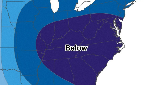
The arctic blast of unseasonably cold weather roared into Georgia Sunday on strong, gusty winds, sending temperatures plummeting throughout the day. And most of the state is also bracing for some form of wintry precipitation – snow, ice or freezing rain or a combination of all three starting Tuesday.
The National Weather Services (NWS) says the best chances for significant accumulations are in south Georgia where 4-5 inches may fall. For the Gainesville area, up to two inches is likely – and there’s only a 20 percent chance of that. The seven-day forecast is available here: 7-Day Forecast 34.31N 83.83W
Sunday saw a high in Gainesville of 47 but that was around 2:00. By daybreak, the temperatures was on a downward swing. Winds increased and so did the wind chill. By nightfall, it was 30 degrees, wind chill 21. At 7:00 this morning it was 17, with 12 mph winds, and a wind chill of +5. The outlook for today for more bitter cold – a high of 33 with winds gusting to 15 mph.
And, in preparation for whatever wintry precipitation Mother Nature brings our way, Georgia DOT crews continue to prepare state roads and interstates.
“The first shift of crews applied more than 800,000 gallons of brine statewide on Sunday during the day, according to a news release. Crews changed shifts Sunday evening to continue brining efforts across the state overnight.
Crews will continue to pre-treat roads on Monday provided the road surface temperatures are favorable. Georgia DOT regularly treats roadways, bridges and overpasses with brine, a mixture of salt and water which is used as a preventative treatment to limit the bonding of ice to the pavement.
A total of 31 brine tankers, each with a 5,000-gallon capacity, are available statewide for deployment to apply brine treatment to interstates, state routes and other critical routes. All have been deployed for this operation.
The primary fleet of tankers is supplemented by smaller units in each Georgia DOT district as well as by contractor forces. Brine solution works best when applied before snow and ice accumulate on roadways when temperatures are at 20 degrees Fahrenheit and above, and when conditions are dry.
8:45 A.M. SUNDAY UPDATE:
It’s a mixed bag of winter weather advisories that have been posted for our area and other parts of Georgia by the National Weather Service (NWS).
First of all, there’s an Extreme Cold Warning for 1:00 Monday morning through noon Monday for Fannin-Gilmer-Union-Towns-Pickens-Dawson-Lumpkin-White-Bartow-Cherokee-Forsyth-Hall-Polk-Paulding-Cobb-North Fulton-Gwinnett-Haralson-Carroll-Douglas-South Fulton-DeKalb counties. It replaces an Extreme Cold Watch that had been posted Saturday for these areas.
What does an Extreme Cold Warning mean? Dangerously cold wind chills as low as -4 below are expected.
It also means plummeting temperatures throughout the day Sunday. The day’s high in Gainesville, recorded by the NWS at the airport, was 47.
Now, in addition to that, some counties in the Gainesville area and elsewhere in north Georgia are under a Winter Storm Watch. That covers most of the state and includes Forsyth-Hall-Banks-Jackson-Gwinnett-Barrow-and extends well into south Georgia. It’s in effect Tuesday morning through Wednesday morning.
What does it mean? Periods of snow that could be moderate to heavy at times. Total snow accumulations between 1 and 3 inches possible. Light sleet and freezing rain will be possible in portions of east
central Georgia late Tuesday night. Ice accumulations less then 0.1 inch possible.
EARLIER STORY. POSTED 8:15 A.M.:
The Georgia Department of Transportation’s (GDOT) road-treating trucks began doing their thing again at 7:00 Sunday morning.
It’s all part of the department’s preparation for another winter storm expected to hit Georgia again starting Tuesday – the second in less than two weeks. This time, though, they’ll be operating statewide and not just in north Georgia.
The National Weather Service (NWS) is forecasting snow and/or ice statewide – from the mountains to the seashore.
Brine (a combination of water and salt) is being applied to interstates and state roads. GDOT says motorists should slow down if you see one of the trucks and stay back at least 100 feet.


