

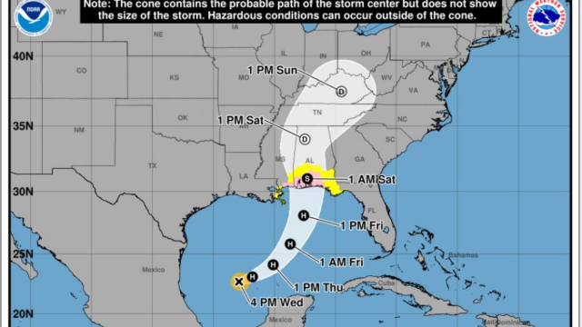
North Georgia residents are being urged to closely monitor weather forecasts as Tropical Storm Isaias continues to develop over the western Gulf and is expected to move north and east in the coming days.
Forecasters say confidence is increasing that the storm could affect the region this weekend, although uncertainty remains regarding the exact timing and track of the system.
At this time, the greatest concern is the potential for long-duration gusty winds from Friday night into Saturday. Strong winds could down trees and power lines, creating scattered power outages and travel hazards across the region.
In addition to the wind threat, forecasters are also monitoring the possibility of heavy rainfall that could lead to localized flash flooding and river flooding, especially in flood-prone areas. Saturated ground combined with gusty winds could increase the likelihood of trees being uprooted.
There is also the potential for isolated tornadoes as the storm moves inland, adding another layer of concern for emergency managers and weather officials.
The current window for impacts appears to be late Friday through Saturday, but officials stress that exact timing could still change as the storm continues its track toward the Southeast.